Cairns sits at a specific kind of crossroads. To the north lies the Torres Strait - a major international shipping corridor handling several thousand large vessels each year, threaded with shoals and driven by fierce tidal currents. To the northeast, Coral Sea routes lead toward Vanuatu and New Caledonia. Northwest puts a vessel in Indonesian waters inside two days. None of these routes forgives failing electronics. A chartplotter that reboots in the Torres Strait, a radar antenna that quits in a squall line, or an AIS transponder that was never correctly registered - these are not inconveniences. They are the start of emergencies. What follows is a practical pre-departure audit built specifically for the Cairns departure, covering every layer of the navigation electronics stack.
Why Nav Electronics Matter More from Cairns
Three factors make Cairns departures uniquely demanding, and they compound each other.
The first is the tropical weather environment. Squall lines build from a clear sky to a lightning-riddled mess in under twenty minutes at this latitude. Offshore radar is not a luxury here - it is the only instrument that gives spatial warning of squall cells before they arrive. Tropical UV also degrades screen coatings and plastic enclosures faster than temperate climates. Salt spray in humid air corrodes connectors left unattended for a season. Equipment that sat in marina conditions for six months may look fine and perform unreliably.
The second factor is reef density. The Great Barrier Reef cannot be navigated by feel in poor visibility. The Torres Strait is a maze of shoals, sand cays, and tide-driven current sets that demand dedicated large-scale charting and constant depth awareness. The AUS 700 chart, covering the Western Approaches to Torres Strait at a scale suited to shoal-fringed navigation, is the primary official chart for this passage - not the global basemap preloaded on a new MFD.
The third factor is commercial traffic. The Torres Strait is a significant shipping corridor for bulk carriers transiting between East Asia and Australian east-coast ports. These vessels travel fast and maneuver slowly. A Class B/SOTDMA AIS transponder - which provides more frequent position reports and accesses transmission slots more efficiently than a standard Class B unit - is a direct safety instrument in this corridor, not a courtesy fitment.
Beyond the strait, the passages to Darwin, Indonesia, and PNG are long and services are scarce. A component that fails in the Banda Sea stays failed. Sourcing in Cairns before departure is always the better option.
The Pre-Departure Audit
Run this audit at least four weeks before departure to allow time for ordering parts, booking labour, and scheduling a haul-out if through-hull work is needed.
- Check every display in daylight and at night. Look for delamination, pressure spots, UV hazing, and dead zones in the touch layer. A screen that reads acceptably at the dock may be unreadable in bright tropical sun at sea.
- Inspect every external connector and cable termination. Remove weatherproofing tape where present, look for green oxidation on pins, and flex each cable near its connector to find chafe damage. Connector corrosion in tropical salt air is the single most common cause of intermittent sensor failure offshore.
- Trace all cable runs below decks. Find chafe points where cables cross edges, pass through bulkheads, or run near moving parts. A cable that chafes through to its shield at sea injects noise across the whole instrument network.
- Check all mounting hardware. Vibration works fasteners loose. Inspect radar arch mounts, chartplotter bracket bolts, and transducer through-hull fittings. A through-hull that seeps slightly at the dock will leak badly in a seaway.
- Update firmware on every device. Chartplotters, radar heads, AIS units, and instrument processors all receive updates that fix bugs, improve chart rendering, and resolve interface issues. Log the firmware version on each device after updating so you have a baseline record for any troubleshooting offshore.
- Verify NMEA 2000 backbone integrity. Power on the full system and confirm every device appears on the network list. An intermittent or missing device is usually a cabling or termination issue rather than a device failure - and is far easier to fix at the dock.
- Test GPS fix acquisition time from cold. A unit that takes several minutes to acquire a fix after power-on may have a failing internal clock battery or a degraded antenna connection. Test this in open water away from marina structures that block sky view.
Chartplotter and MFD
Screen Size and Interface
A modern multifunction display integrates chartplotter, radar overlay, sonar, AIS target display, autopilot control, and engine data over a single NMEA 2000 or NMEA OneNet backbone - reducing separate displays, power feeds, and failure points. For offshore passages from Cairns, this integration is worth prioritising over the cheapest unit that checks the box.
Screen size matters practically. For split-screen use with chart and radar overlay running simultaneously, a larger display is worth the investment - you need to read bearing lines and target labels at a glance in a watch-keeping environment. Touch-only units become difficult to operate accurately in a rough tropical seaway. Wet hands, boat movement, and stress all work against precise touch input. Raymarine's HybridTouch interface - physical buttons combined with a touchscreen - is consistently rated better for offshore conditions. B&G's rotary-knob interface serves the same purpose and is well-regarded by offshore sailors for one-handed operation in a seaway.
Brand Comparison
Garmin's GPSMAP 9000 series, expanded in late 2025 across multiple screen sizes, ships with preloaded BlueChart g3 charts enhanced with Navionics data. Furuno's newer TZtouchXL line added AI routing and a new TZ Maps chart engine in 2025; the established NavNet TZtouch3 remains a capable offshore MFD and Furuno's DRS-NXT open-array radar heads are widely chosen on vessels making blue-water passages. Simrad is valued for its tightly integrated autopilot systems. B&G targets the sailing market specifically, with instrument integration and sail-performance data that other brands treat as secondary.
Whatever brand you select, confirm it supports the chart format you intend to carry for Torres Strait and beyond before purchasing either the display or the chart card. Not all MFDs read all formats.
Chart Coverage
The Official Chart Layer
No single chart product covers all the waters between Cairns and Darwin, Indonesia, or PNG with equal confidence. The strategy is layered coverage.
For the Torres Strait, the AUS 700 chart is the primary official paper chart and should be onboard in a current, dated edition. AMSA also publishes free downloadable Torres Strait navigation maps for passage planning at amsa.gov.au/safety-navigation/navigating-coastal-waters/torres-strait-maps - these are separate from commercial chart cards and complement rather than replace them. Download and print them before departure.
Digital Chart Cards
- Navionics (now owned by Garmin and sold as chart cards and subscriptions) covers Australian coastal waters well and offers some Indonesian coverage, but user-contributed data quality varies. Verify coverage extent against your actual waypoints before committing to it offshore.
- C-MAP's MAX-N+ and REVEAL products add high-resolution satellite imagery overlay in shallow reef areas - directly useful for reef transit through the Great Barrier Reef and Torres Strait approaches.
- BlueChart g3, preloaded on Garmin units, is reliable for Australian waters and reasonable for Indonesian port approaches, but verify coverage against your planned waypoints specifically.
- Both Navionics and C-MAP offer subscription update services. Update the card before departure. Indonesian and PNG waters are areas where chart data is notoriously patchy and improves with each data cycle - an older card may lack detail that a current version includes. This is not optional maintenance.
Carry official paper charts and digital charts as independent layers. If the chartplotter loses power, paper charts and a handheld GPS are what you navigate home on.
Radar
Radar is not optional for any Cairns departure heading north or northwest. The Torres Strait demands it for collision avoidance with commercial traffic. The squall environment of the Coral Sea demands it for weather avoidance. Long legs to Indonesia require it for night watches when no visual references exist for hours at a stretch.
| Feature | Radome | Open Array |
|---|---|---|
| Detection range | Moderate - adequate for coastal use | Extended - standard for offshore passages |
| Beam width | Wider - lower target discrimination | Narrower - better separation of close targets |
| Power consumption | Lower - suits smaller battery banks | Higher - requires larger power budget |
| Installation | Simpler - self-contained unit | More complex - separate scanner and pedestal |
| Best suited for | Coastal cruising, smaller vessels | Blue-water passages, vessels over about ten metres |
For any vessel making a passage beyond the reef system, an open-array scanner is the standard choice. Its narrower beam width separates targets - critical in the Torres Strait where a squall cell and a ship's radar echo can appear in the same arc on a radome display. Solid-state (broadband) radar performs well at close range and in rain clutter; traditional pulse radar recovers target discrimination at longer ranges in some conditions. Some offshore vessels carry both technologies.
Installation quality affects real-world performance more than brand choice. A well-mounted, correctly aligned open-array scanner outperforms a premium unit installed with poor cable runs or incorrect heading alignment. Hardware costs and installation labour combined represent a significant investment - get quotes from local Cairns marine electronics installers for current pricing, as it varies with vessel type and existing infrastructure. The installer you choose will also know the local failure patterns in tropical conditions.
AIS Transponder and MMSI Registration
A Class B AIS transponder broadcasts your vessel's position, course, speed, and identity to other vessels and shore stations, and receives and displays other vessels' AIS data on your MFD. Both functions are critical in the Torres Strait shipping lanes.
MMSI Registration in Australia
Before an AIS transponder can transmit, it must be programmed with a valid MMSI - Maritime Mobile Service Identity number. In Australia, this is not a self-registration process. To obtain an Australian MMSI, the vessel owner must hold a qualifying marine radio operator certificate. If the vessel carries an MF/HF radio, an ACMA maritime ship station licence and callsign are also required; vessels with VHF radio only operate under a class licence and a separate ACMA ship station licence is not required for that equipment. AMSA administers the MMSI allocation. Start the paperwork early - allow several weeks from application to programmed transponder. Current requirements and the application process are at amsa.gov.au/mmsi.
For the Torres Strait specifically, a Class B/SOTDMA unit is worth the upgrade over a standard Class B. SOTDMA units self-organise their transmission slot access more efficiently and broadcast position more frequently in congested AIS environments - which is precisely what the Torres Strait shipping corridor is. Once programmed, enter complete vessel data - name, call sign, vessel type, dimensions, and destination. Integrate the AIS with your MFD so targets overlay on the chartplotter display and dangerous-approach alarms are active. Before leaving the marina, verify your transponder appears on a third-party AIS receiver or on a vessel tracking service.
Depth Sounder and Transducer
Depth information is non-negotiable in reef waters. A basic echo sounder gives you a number. A modern CHIRP transducer integrated with the MFD gives you bottom type, target separation at depth, and the ability to distinguish a reef head rising from the bottom before you are directly over it.
For a cruising yacht operating across the Great Barrier Reef and Torres Strait, lower-frequency CHIRP transducers provide maximum depth penetration for offshore legs while maintaining resolution in shallow reef terrain. Traditional single-frequency transducers at standard cruising frequencies handle simple depth reading but lack the resolution to distinguish bottom structure in complex reef environments.
Transducer replacement is through-hull work. If your existing transducer is more than five years old, produces inconsistent readings, or has a degraded hull seal, replace it during the haul-out. Doing this when the boat is already on the hard costs far less in labour than arranging a separate slip. After installation, calibrate the keel depth offset - most MFDs default to displaying depth below the transducer, not below the keel. In reef water, that difference is operationally significant.
Instrument Suite and NMEA 2000 Backbone
Backbone Integrity
Wind speed and direction, boat speed, and log data feed directly into routing decisions on passage. A wind instrument that quits in squally conditions removes your ability to judge gusts quantitatively. These sensors are worth servicing before departure.
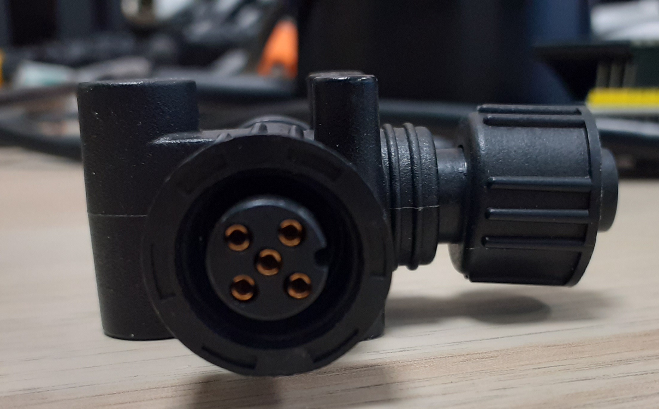
All instruments - chartplotter, radar, AIS, depth sounder, autopilot - connect over the NMEA 2000 backbone, which carries both data and power on a single cable running through the vessel. Each device connects via a T-piece and drop cable. Both ends of the backbone must be terminated with the correct-resistance resistors. This is the most consistently overlooked installation detail on boats where devices have been added incrementally over several seasons.
An incorrectly terminated NMEA 2000 backbone is a common cause of intermittent instrument failure offshore - symptoms appear as random device dropouts, erratic readings, or devices that work at rest but fail under vibration.Actisense NMEA 2000 Installation Guide
Test your backbone termination before departure. A multimeter across the backbone with power off will confirm correct termination resistance end to end. Signs of a mismatched or damaged backbone include:
- Instruments appearing and disappearing from the MFD device list without explanation
- Autopilot heading reference dropouts, particularly under vibration
- AIS targets that freeze and then jump position
- Depth readings that drop to zero and recover without apparent cause
Tropical Connector Maintenance
NMEA 2000 connectors are rated for outdoor use but are not immune to prolonged salt spray. Inspect every connector junction on the backbone - particularly any installed in cockpit lockers or the bilge - and apply marine-grade dielectric grease to exposed pins. In the tropical environment, moisture ingress at backbone connectors is a failure mode that rarely presents until the vessel is offshore and vibration stresses marginal connections.
Vessels with older NMEA 0183 instrument systems can interface with modern MFDs via converter gateways, but the converter itself becomes a potential failure point and the integration is less direct than a native NMEA 2000 system. If a major electronics upgrade is already planned, converting to a full NMEA 2000 backbone at the same time eliminates the bridging problem permanently.
Booking Your Electronics Work in Cairns
Cairns has working boatyards - primarily clustered around the Cairns Slipway and Marlin Marina precinct - with marine electronics installers experienced in offshore passage preparation. The sequencing of work matters as much as the work itself.
Transducer replacement requires the boat to be hauled. Coordinate electronics work with your haul-out and antifouling schedule. When the boat is on the hard, the transducer through-hull is accessible from outside without a diver, the hull seal is done properly while dry, and any recut to the existing hole is straightforward. Arranging transducer work after the boat is back in the water means a second slip fee and separate mobilisation charge. If you are doing a full electronics refit, complete below-decks cable runs before the haul-out begins, then finish antifouling and transducer work as a single operation.
Radar arch installation, antenna mounting, and cockpit display work can be done afloat on a calm day in the marina. Below-decks cable runs through tight engine room or bilge areas are easier on the hard when the boat is not subject to tidal movement and there is better access from outside.
Allow two to three weeks minimum for sourcing parts - longer for specialist items. High-demand open-array radar scanners from Furuno and Garmin are not always held in stock in Cairns and may need to be freighted from Brisbane or Sydney. Chart cards for Indonesian and PNG waters are not stocked locally at the depth available for Australian charts - order them in advance and confirm the update workflow for Navionics or C-MAP at the same time, so the cards are current when they arrive.
Also confirm your VHF radio has Class D DSC capability with a connected GPS feed. Channel 70 is reserved exclusively for DSC digital distress and calling in Australian waters - after transmitting a DSC distress alert, the vessel monitors Channel 16 for response. A DSC-capable radio linked to a GPS position is what search and rescue receives. Confirm your EPIRB is AMSA-registered and in-date. GPS-enabled EPIRBs improve rescue location accuracy dramatically and are strongly recommended; requirements for GPS-equipped EPIRBs vary by vessel class and operational area and are being progressively mandated - check current requirements for your specific vessel at amsa.gov.au/distress-beacons before departure.
Frequently Asked Questions
Do I legally need an AIS transponder to transit the Torres Strait?
Australian regulations do not mandate AIS transponders on recreational vessels below a certain size. Operating without one in the Torres Strait shipping lanes is nonetheless a serious practical risk - commercial vessels rely on AIS for traffic separation and a vessel not broadcasting is effectively invisible to their watch systems. Fit a Class B or Class B/SOTDMA unit and register your MMSI with AMSA before departure.
How do I get an MMSI number in Australia before my departure?
You need a qualifying marine radio operator certificate. If your vessel carries an MF/HF radio, an ACMA maritime ship station licence and callsign are also required; for VHF-only installations, a separate ACMA ship station licence is not mandatory. Once these requirements are met, apply to AMSA for MMSI allocation through the process at amsa.gov.au/mmsi. Allow several weeks from application to programmed transponder - this is not a same-day process. Your electronics installer can program the MMSI into the transponder once it is issued, but the qualification must be in the vessel operator's name.
Are the charts preloaded on a new MFD adequate for the Torres Strait and Indonesia?
Not at the detail level you need for passage-making in reef water. Preloaded basemaps give coastal outlines and major buoys, but the Torres Strait requires dedicated charting at appropriate scale. Indonesian and PNG waters are areas where commercial chart data from all providers is patchy - update your chart card immediately before departure, download the free AMSA Torres Strait maps as a separate layer, and cross-check your planned waypoints against both sources. Never plan a reef-water passage based on a basemap alone.
What are the signs that my NMEA 2000 backbone has a termination problem?
Instruments appearing and disappearing from the MFD device list, autopilot heading dropouts under vibration, AIS targets that freeze and then jump, and depth readings that zero out briefly are all typical symptoms. The fault often only surfaces underway when vibration stresses marginal connections. Test the backbone resistance with a multimeter before departure - it takes less than five minutes and eliminates the most common cause of intermittent instrument failure at sea.
Can I replace a transducer without hauling the boat?
A keel-mounted or transom-mounted through-hull transducer can be replaced afloat using a diver, but it costs more and the seal quality is harder to guarantee than work done on the hard. If antifouling is due before departure, combine both operations in a single haul-out. In-hull transducers, which mount inside a fibreglass hull without a through-fitting, can be replaced afloat without hull access, though performance is reduced compared to a direct water-contact transducer.
How far in advance should I book electronics installation in Cairns?
For a full refit involving radar, MFD replacement, AIS, and transducer work, allow a minimum of four to six weeks from first contact with an installer to a completed, sea-trialled installation. Haul-out slots at Cairns-area yards fill quickly before the northbound passage season. Source parts at the same time you book the installation - waiting for freighted components after the yard slot starts costs berth fees while nothing happens.